Nexus Twin

East2north har under 2025 blivit nya medlemmar i nationella hubben för digital tvillingar. I denna artikel så presenterar de lösningen Nexus Twin och dess centrala funktioner.
Nexus Twin: A Data-Centric Platform for Sustainable Cities
As cities expand and urban planning grows in complexity, data-driven decision-making can help address issues like disconnected workflows, siloed data, and inefficient collaboration. Nexus Twin is a centralized digital twin platform that integrates BIM, GIS, IoT, and automation into a single data environment for urban development projects.
Centralizing Data from Diverse Sources
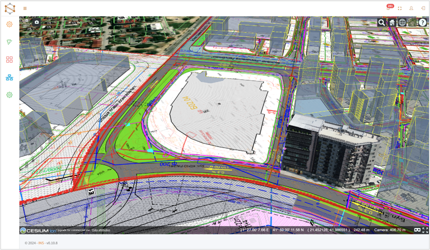
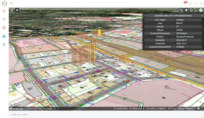
Nexus Twin is designed to aggregate and synchronize real-time, multi-source data in support of more sustainable and efficient city management. The platform includes:
- WMS & WFS for GIS – Integrating real-time geospatial data
- openBIM (.IFC format) for BIM models – Facilitating collaboration
- Point Clouds & Photogrammetry – Providing high-precision 3D visualization
- IoT provisioning – Incorporating real-world sensor data for monitoring
It uses a tiling and hierarchical Level-of-Detail (LOD) approach to visualize complex 3D models, ensuring efficient navigation and interaction at city scale. By combining these data types in one interoperable ecosystem, Nexus Twin supports analysis, simulation, and decision-making for urban planning and infrastructure management.
Bridging the Gap Between BIM and GIS
A persistent challenge in digital urban planning has been the disconnect between BIM and GIS. Nexus Twin addresses this issue with a built-in BIM-to-GIS conversion tool, allowing building models to be integrated into geospatial environments. This process aims to:
- Present real-world building data in a geographic context
- Provide architects and engineers with location-based insights
- Give decision-makers access to comprehensive, real-time urban information
By incorporating both BIM and GIS, Nexus Twin helps different disciplines collaborate more effectively.
AI-Powered Common Data Environment (CDE) for Collaboration
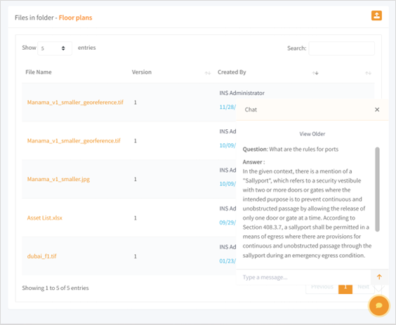
At the core of Nexus Twin is its AI-powered Common Data Environment (CDE), a centralized workspace designed to streamline project coordination. Key features include:
- Automated data organization and retrieval
- AI-driven analytics for deeper insights
- Reduced errors and improved compliance tracking
This secure, cloud-based workspace aims to ensure that city planners, developers, and other stakeholders work with consistent, up-to-date information.
Automating Construction & Digital Permitting
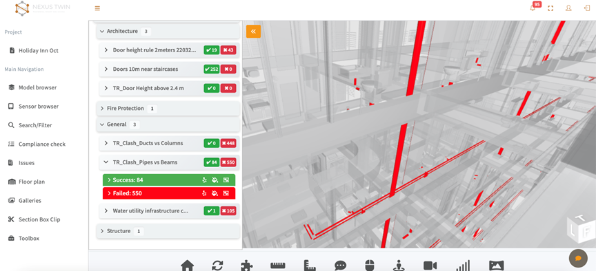
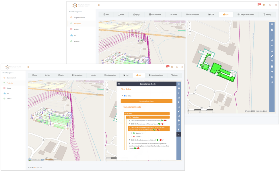
Nexus Twin includes automation tools that can reduce manual tasks, especially in digital building permit processes. These tools:
- Automate compliance checks, potentially speeding up approvals
- Reduce the likelihood of errors
- Facilitate data exchange between authorities and stakeholders
By integrating AI-driven automation, Nexus Twin allows teams to focus on innovation and sustainable solutions rather than administrative tasks.
Interoperability & Open Standards: Future-Proofing Smart Cities
Nexus Twin emphasizes interoperability and open standards to help ensure long-term flexibility. The platform supports:
- IFC (for BIM)
- GeoJSON, WMS/WFS (for GIS)
- E57/LAZ (for point clouds)
This vendor-neutral approach allows organizations to align Nexus Twin with existing workflows, helping keep data reusable and adaptable over time.
A Blueprint for the Future of Urban Development
Digital twins serve as evolving models that can grow and adapt alongside cities. By integrating BIM, GIS, IoT, AI, and automation in one platform, Nexus Twin aims to help stakeholders plan and manage more resilient and sustainable urban environments.
